
Hidden coves, secret bays and unknown inlets have suddenly become a whole lot more accessible thanks to new 3D mapping software launched by Ordnance Survey.
The programme offers stunning aerial views of the entire UK coastline, allowing you to search out potential set ups from the comfort of your own home.
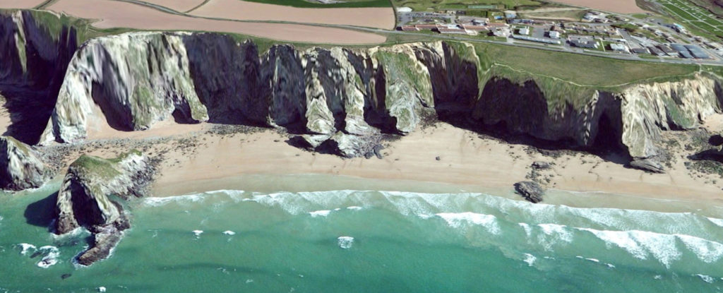
The immersive tool will allow surfers a greater understanding of the topography of the coastal landscape, and help you search for new slabs, points and wedge-producing headlands. Of course, finding a potential set up on here is just the start, and it doesn’t take out all the leg work, as you’ll still have to work out the conditions each spot needs.
The programme will also help you figure out the accessibility of your new found spots, with the maps highlighting any potential dangers like cliffs and crags that may crop up en-route.
The immersive tool will allow surfers a greater understanding of the coastal landscape
Nick Giles, Ordnance Survey’s leisure managing director explained that the tool is perfect for adventurers.
“It helps them to plan in accordance with their skills and experience. And importantly, being able to see routes clearly in this way should help people get inspired to do more in the great outdoors and at the same time keep safe.”
The Aerial 3D technology is currently available for a free trial, after seven days access costs £19.99.
Despite digital seemingly taking over in every aspect of our lives, according to Ordnance Survey sales of paper maps is up from 1.8 million in 2013 to 1.9 million last year.
