
Britain is on high alert as a raft of storms are set to batter the coastline this week bringing with them the biggest surf so far this year.
Waves are set to swell to in excess of 20ft in some areas as the storm (which may be named Doris) slams into the country causing upset and disruption as she moves through.
The storm is building up due to low pressure systems in the Atlantic ocean and the jet stream currents are directing the surge of hideous weather directly at the UK.
This is the first of a number of storms that is set to batter the UK this month and next
A sheltered corner lights up last year up on a very windy morning. Photo Luke Gartside
The storm is set to impact Cornwall first before moving further east enveloping the entire country.
The swell is expected to peak on Friday in the south-west with a 21.5ft at 18 secs swell forecast for the morning. Solid surf is predicted to continue throughout the weekend and into the first half of next week, however the longer range chart is still extremely susceptible to change.
The front edge of the swell hits on Thursday, coming almost directly from the south, meaning it’s possible not a huge amount will wrap round to Cornwall, Devon and Wales’ north-west facing coasts. The swell will be accompanied by howling south, south-east winds, which although favourable in direction for most north coast spots, are likely to be too strong for most places. The name of the game for both Thursday and beyond will be seeking shelter.

Dale Foster releases the fins on a stormy day last winter. Photo Luke Gartside
The swell and wind then swing around to the south-west for the peak of the swell on Friday morning, creating giant surf everywhere. Some models are forecasting that the wind will become uncharacteristically light by lunch time and then swing round to the north-west for the afternoon. However The Met Office has wind remaining strong from the south-west all day, which seems more likely to us. Look for spots facing away from the swell and wind on north facing coasts for more manageable conditions.
Currently, Saturday and Sunday are set to be a little bit smaller, hopefully opening up a few more sheltered options for the weekend warrior, however the wind remains strong and from the south-west.

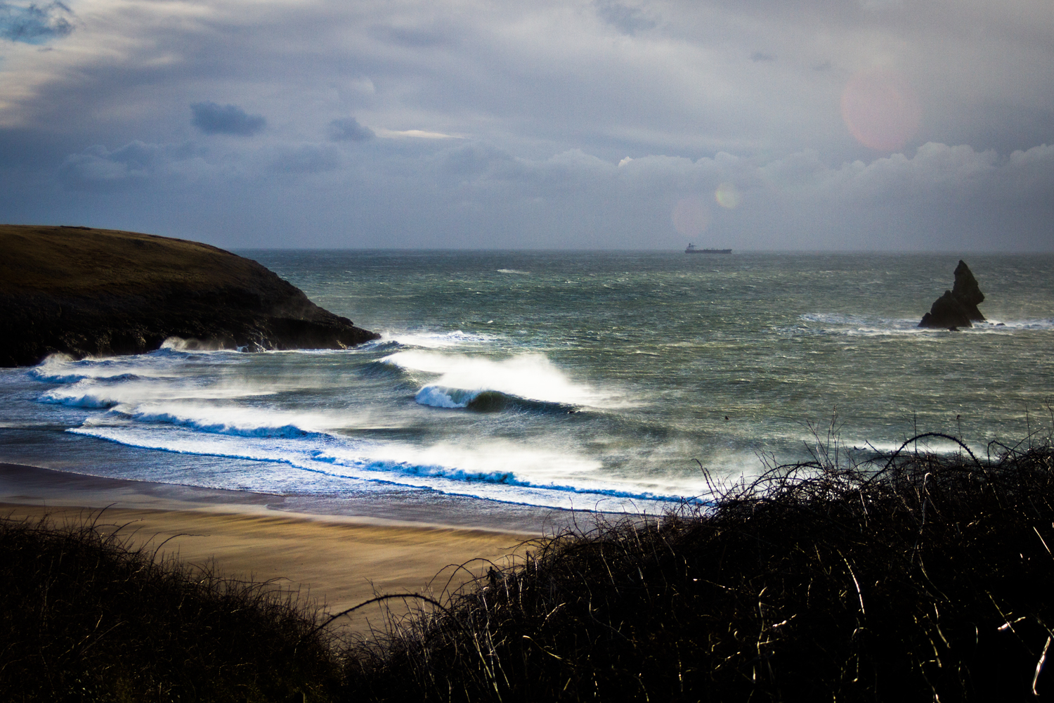
Howling winds from the South will mean Cornwall’s South Coast will be a total write off for this storm swell. Shame, we could do with some of this. Photo Luke Gartside
This is the first of a number of storms that is set to batter the UK this month and next, forecaster Eric Leister from Accuweather said: “A shift in the overall weather pattern will bring the return of potent Atlantic storms to the United Kingdom from late January into February.”
“This expected outbreak of storms will be a significant change from what has occurred across the UK so far this year.”
See our story
Storm Angus Batters Brighton but Brings Strong Surf
“A dominating area of high pressure has been centred over central and western Europe during much of January, shielding the UK from any significant storm systems.”
“There have been no named windstorms during the month of January.”
“However, this pattern change will likely yield multiple named storms during the month of February.”
Temperature contrasts will drive a strong #jetstream across the Atlantic bringing the #UK spells of wet, windy and milder weather this week pic.twitter.com/acGKly6EGE
— Met Office (@metoffice) January 30, 2017

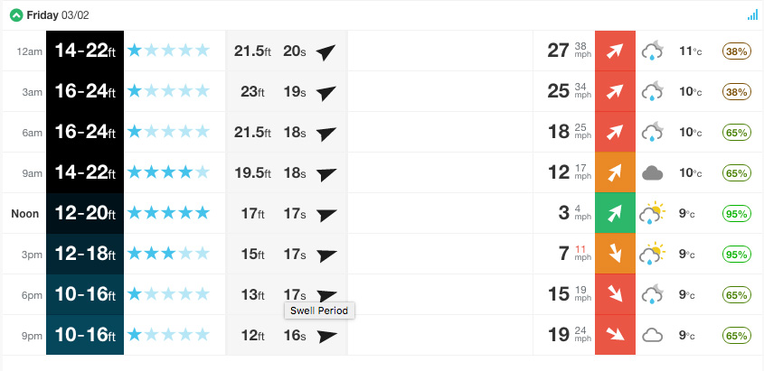
The forecast for Cornwall’s Watergate Bay on Friday. Image: Magic Seaweed
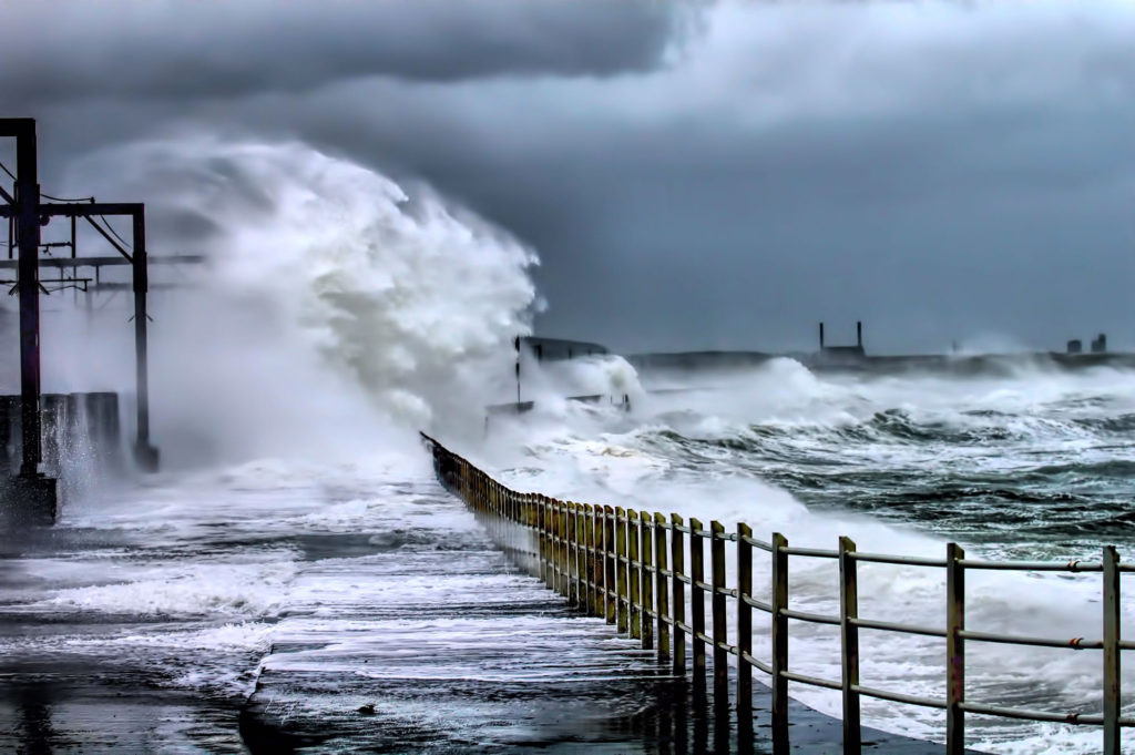
Lead Image: A storm at Saltcoats, Scotland. Oliver Clarke