Today, a new record has been set for the warmest October sea temperature for mid-to-late October at Fistral.
The ocean today is currently at 16.5 degrees C, with the previous highest temperature recorded on this specific dat over the past 10 years sat at 15.7 degrees C, which was set back in 2022.
By sitting at 16.4 and 16.5 degrees C, the ocean right now is almost one full degree warmer than any previous late October day on record.
The warmer water is drive by a gigantic, ongoing regional climate event – a prolonged marine heatwave that’s currently impacting UK and Irish waters. Even by the end of May, the ocean temperature was up by 2 degrees above the average, and has continued this trend into autumn.
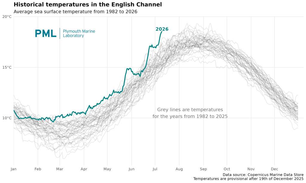
Historical temperatures in the English Channel on that upward trend in July thanks to the heatwave. Photo: PML
And while we may celebrate the added time in 3/2 wetsuits, Dr Zoe Jacobs has been monitoring the marine heatwave (MHW) and made a couple of observations: “Globally, MHWs have caused wide-ranging impacts on marine ecosystems. This includes the mortality of key species such as seagrass and kelp, the mortality or reorganisation of commercial fisheries and the initiation of harmful algal blooms (HABs).
“It may also lead to a temporary disappearance of cool-water species and emergence of warm-water species or the disruption of marine species’ life cycles , impacting their growth or reproduction. All of this may impact the regional marine ecosystem, fisheries and the economy in different ways.
“With climate change continuing to raise global temperatures, it’s vital that these occurrences are monitored, and that we have more targeted research to understand these impacts to improve UK resilience to MHWs.”
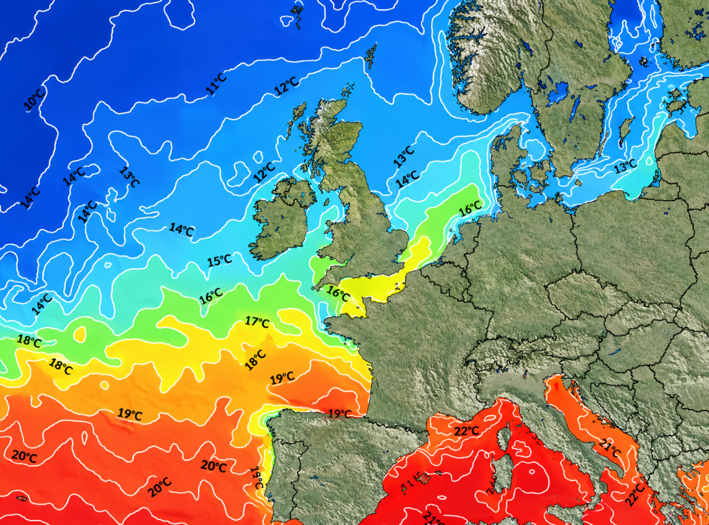
See that bubble around Cornwall and Wales? That’s the pocket of heat.
According to the National Oceanography Centre (NOC) the English Channel and the southwestern approach to the Celtic Sea have been stuck in a category II marine heatwave, with sea surface temperatures across the shelf hovering around 2-to-3 degrees C higher than normal throughout the autumn.
There is not enough data to suggest the warming of the Pacific Ocean, aka El Nino, has had an impact on the marine heatwave. In fact, it’s almost certainly it has not. The heatwave is better explained by the fact that temperatures naturally lag behind the air by about six to eight weeks.
Because the UK experienced an unseasonably warm late summer and early autumn, the massive volume of the Atlantic Ocean acted as a giant battery, storing immense thermal energy. Without sustained sub-zero Arctic winds or major storm mixing to pull that heat down into the deep ocean trenches, the shallow coastal waters around Cornwall have held onto that summer warmth far longer into October than usual.
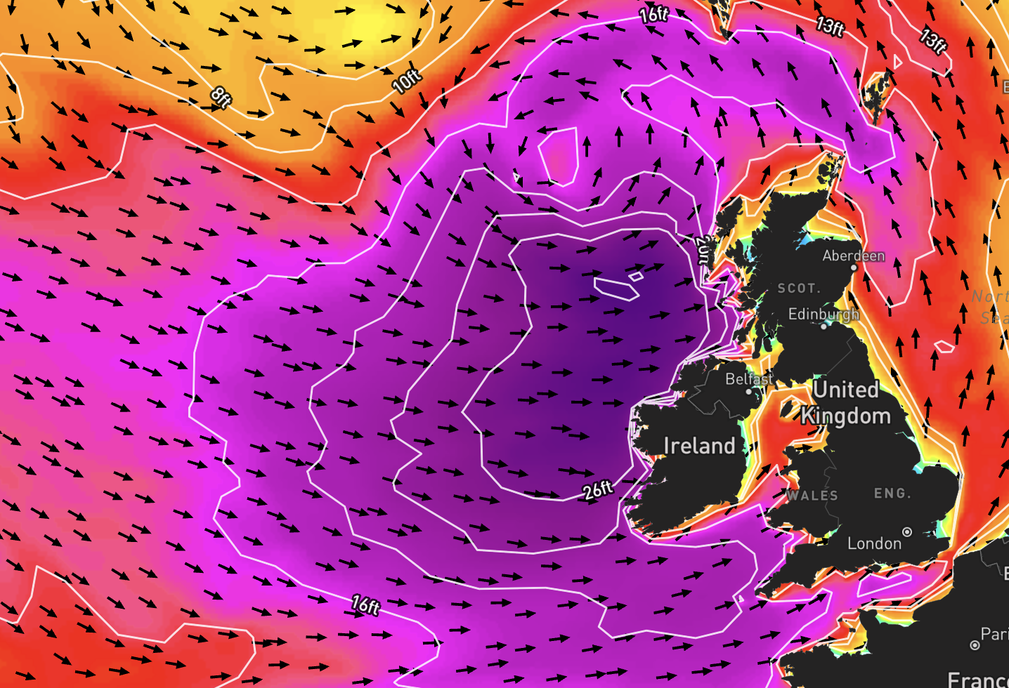
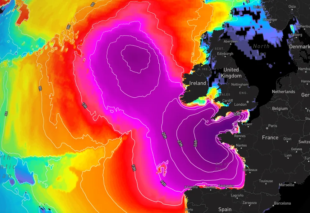
However with Storm Austen landing, change is literally on the horizon; the first major Atlantic low-pressure storm systems of the season will bring heavy wind gusts up to 70 mph to Newquay this weekend, churning up the sea and forcing the warm surface layer to mix with that cooler deep water – so expect to feel a chill in the ocean over the next few days.