
Two North Atlantic hurricanes are set to converge and create what forecasters are calling a UK bound superstorm, set to arrive on our shores at the end of this week.
The two hurricanes, named Maria and Lee, have already had a significant impact on the other side of the Atlantic. Maria, which is the tenth most intense Atlantic hurricane ever recorded, caused catastrophic damage as it tore through Dominica and the north-east Caribbean and lead to evacuations in North Carolina.


The colliding depressions off the coast of the USA. Image Magicseaweed
It also brought pumping waves, accompanied by largely favourable winds gracing the length of the USA’s east coast.
Western Europe has also been enjoying the tail end of a succession of low pressure bands which have made their way across the Atlantic over the last week or so, and with this new superstorm in the works, the run of swell looks set to continue for the foreseeable future.


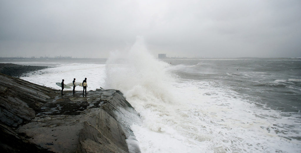
Big splash on the South Coast of Cornwall. Photo Nick Pumphrey
This morning weather models have indicated that a third low pressure lingering off Canada also looks set to join the party, creating what could potentially be a mammoth swell event.
However, before you get too excited, there are still several factors at play which will determine if the system will deliver pumping waves to the British coastline. Most importantly; the depressions strength and trajectory as it moves away from the US coast and the accompanying winds.

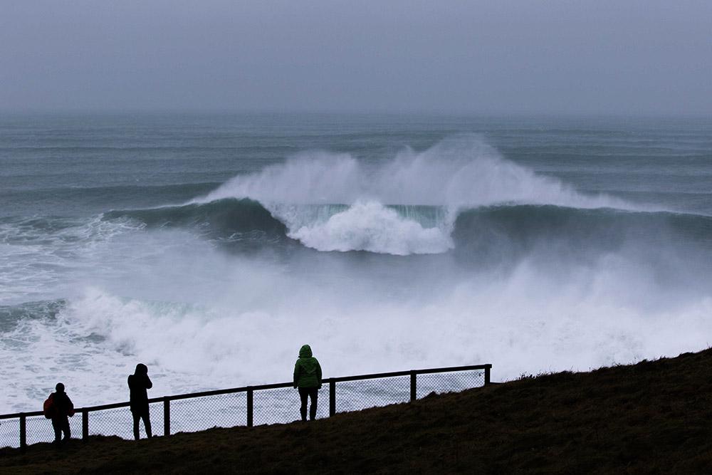
Newquay’s Cribbar flexing its muscles during Storm Doris. Photo Luke Lane Prokopiou
Right now, the forecasts are super volatile and changeable, but they’re suggesting a solid week of good sized, but not huge, swell for much of the UK.
Devon, Cornwall, Northern Ireland and Scotland look to be bearing the brunt of the swell initially, with the east coast set to receive a sizeable pulse in the middle of next week. The accompanying winds look likely to be strong and initially from the SW, before swinging to the NW at the start of next week, rendering most of Devon and Cornwall’s north west facing coastlines a write off until thy lighten and swing more westerly towards midweek. Similarly, by the time the swell reaches Scotland’s North coast the accompanying wind is NW, making for tricky conditions at exposed north facing spots.

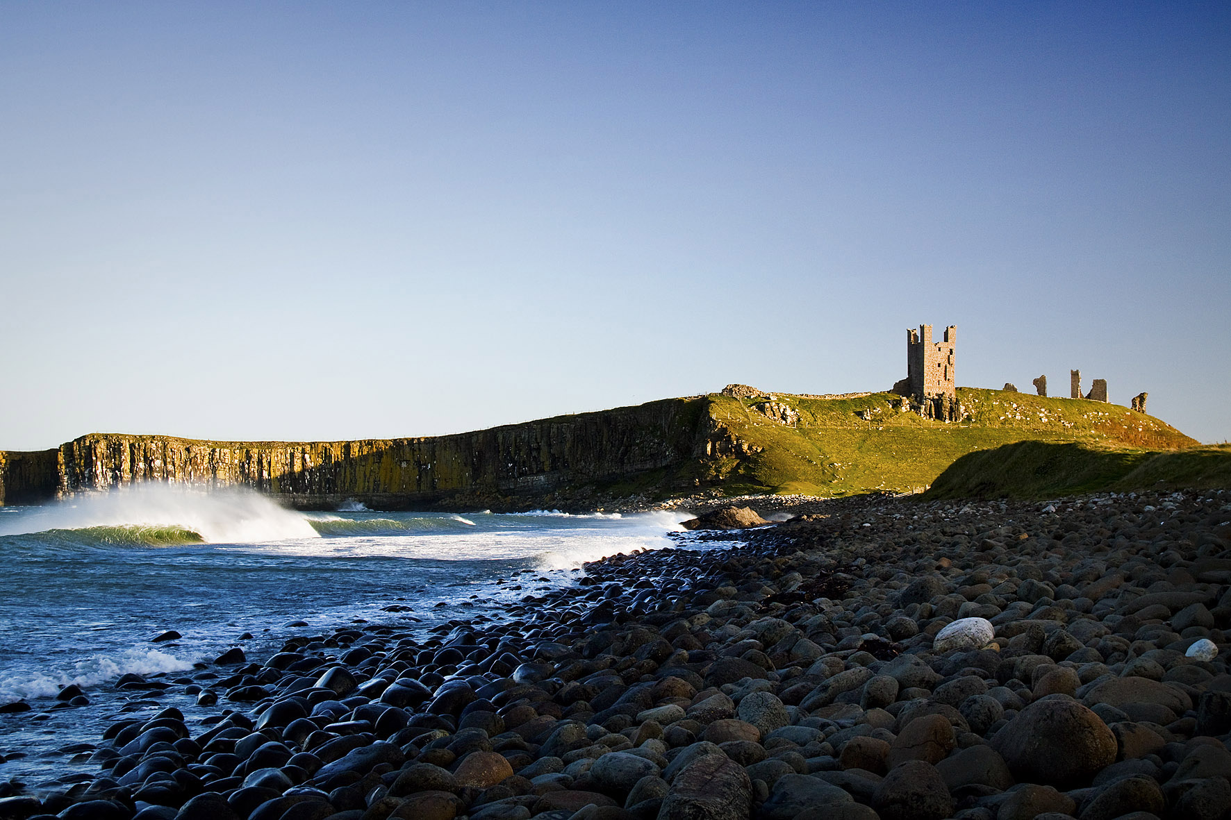
An east coast beach break in the shadow of a grand castle. Photo Greg Martin
By the time the swell makes it round the corner to the east coast of Britain the wind looks set to have eased a little, however the swell is still solid, meaning sheltered options out of the wind will be the go.
As it looks at the moment, south coast spots further up the channel are unlikely to receive anything like the size of swell being enjoyed elsewhere, however, the accompanying north-westerly winds are more favourable than in many places, making short period, fairly clean waves possible as far up the channel as Brighton for the start of next week. Unfortunately the Isle of Wight looks unlikely to bear much fruit.
The winds for South Wales look pretty dire throughout the swell, and the coastline is also fairly sheltered from the swell by the shadow of Ireland, making any classic days unlikely.

Local Tim Ellman-Brown in Brighton. Photo nomadimage.co.uk
We’ll be updating this as the forecasts change, as they inevitably will, over the course of the next few days.
Cover photo: Lewis Arnold